Architecture and Planning Miscellaneous-topic
- Match the urban forms listed in Group I with the towns listed in Group II
Group I Group II P. Grid Iron 1. New Delhi Q. Radial 2. Washington D.C. R. Linear 3. Copenhagen S. Finger plan 4. Mumbai 5. Canberra
-
View Hint View Answer Discuss in Forum
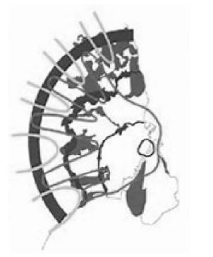
Finger Plan of Copenhagen

The Finger Plan is an urban plan from 1947 which provides a strategy for the development of the Copenhagen metropolitan area, Denmark. According to the plan, Copenhagen is to develop along five ‘fingers', centred on S-train commuter rail lines, which extend from the 'palm', that is the dense urban fabric of central Copenhagen. In between the fingers, green "wedges" are intended to provide land for agriculture and recreational purposes.
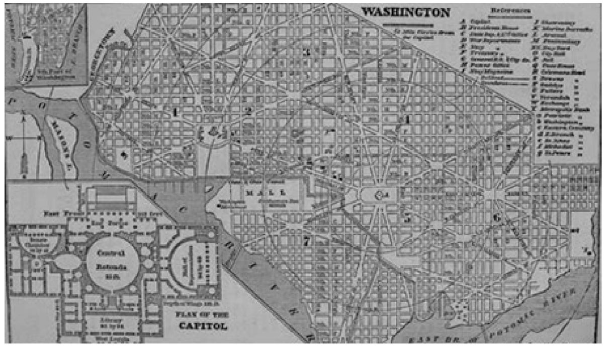
Grid Iron and Radial Plan of Washington D.C. L'Enfant developed a Baroque plan that features ceremonial spaces and grand radial avenues, while respecting natural contours of the land. The result was a system of intersecting diagonal avenues superimposed over a grid system.
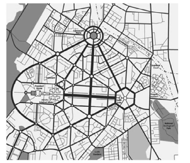
Radial Plan of New Delhi by Lutyens: Designed on a radial plan by Sir Edwin Lutyens, with several key buildings by Sir Robert Baker, New Delhi is a synthesis of Indian and European civic and architectural ideals, with gracious vistas, manicured gardens, watercourses, and tree-lined avenues.
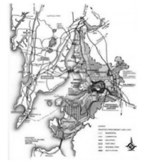
Linear City of Mumbai and Navi Mumbai : The growth of Mumbai is constrained by the sea at south, east and west.
Correct Option: A
Finger Plan of Copenhagen

The Finger Plan is an urban plan from 1947 which provides a strategy for the development of the Copenhagen metropolitan area, Denmark. According to the plan, Copenhagen is to develop along five ‘fingers', centred on S-train commuter rail lines, which extend from the 'palm', that is the dense urban fabric of central Copenhagen. In between the fingers, green "wedges" are intended to provide land for agriculture and recreational purposes.
Grid Iron and Radial Plan of Washington D.C. L'Enfant developed a Baroque plan that features ceremonial spaces and grand radial avenues, while respecting natural contours of the land. The result was a system of intersecting diagonal avenues superimposed over a grid system.
Radial Plan of New Delhi by Lutyens: Designed on a radial plan by Sir Edwin Lutyens, with several key buildings by Sir Robert Baker, New Delhi is a synthesis of Indian and European civic and architectural ideals, with gracious vistas, manicured gardens, watercourses, and tree-lined avenues.
Linear City of Mumbai and Navi Mumbai : The growth of Mumbai is constrained by the sea at south, east and west.
- Match the eminent personalities in Group I with their books and statements in Group II
Group I Group II P. Kevin Lynch 1. The Fountainhead Q. Ayn Rand 2. Small is Beautiful R. Paul D. Spreiregen 3. Site Planning S. E. F. Schumacher 4. Urban Design : Architecture of Towns and Cities 5. Design of Cities
-
View Hint View Answer Discuss in Forum
NA
Correct Option: D
NA
- Identify the CORRECT CAD statements
P. SPLINE connects sequence of line segments into a single object
Q. SPLINE is a smooth curve passing through or near a given set of points
R. PLINE creates straight line segments, arc segments or both
S. PLINE can be closed only when its start and end points are coincident and tangent
T. PLINE allows adjusting the width and curvature of its multiline segments
U. SPLIN E can be exploded into smaller segments
V. PLINE can be converted into a continuous curve segment
-
View Hint View Answer Discuss in Forum
SPLINE : Creates a smooth curve that passes through or near a set of fit points, or that is defined by the vertices in a control frame. SPLINE creates curves called nonuniform rational Bsplines (NURBS), referred to as splines for simplicity. Splines are defined either with fit points, or with control vertices.
Creates a 2D polyline, a single object that is composed of line and arc segments.
PLINE : A 2D polyline is a connected sequence of segments created as a single planar object. You can create straight line segments, arc segments, or a combination of the two.
A temporary plus-shaped marker displays at the first point. This marker can be useful when you create long and complicated polylines. It is removed when you complete the polyline.
The PLINEGEN system variable controls the linetype pattern display around and the smoothness of the vertices of a 2D polyline.Correct Option: B
SPLINE : Creates a smooth curve that passes through or near a set of fit points, or that is defined by the vertices in a control frame. SPLINE creates curves called nonuniform rational Bsplines (NURBS), referred to as splines for simplicity. Splines are defined either with fit points, or with control vertices.
Creates a 2D polyline, a single object that is composed of line and arc segments.
PLINE : A 2D polyline is a connected sequence of segments created as a single planar object. You can create straight line segments, arc segments, or a combination of the two.
A temporary plus-shaped marker displays at the first point. This marker can be useful when you create long and complicated polylines. It is removed when you complete the polyline.
The PLINEGEN system variable controls the linetype pattern display around and the smoothness of the vertices of a 2D polyline.
- A site in a map drawn to scale of 1 : 16000 measures 75 sqcm. The actual area of the site in hectares is
-
View Hint View Answer Discuss in Forum
Scale of the map is 1 :16,000
if it's 1 cm, then real life would be 16000 cm.
1cm × 1 cm = 1 cm2 on the map.
16,000 cm * 16,000 cm = 256,000,000 cm2 in real life.
This means that a farm with an area of 75 cm2 on the map would be equivalent to a site with an area of 75*2,56,000,000 cm2 in real life which would be equal to 19200,000,000 cm2 = 192 hectare.Correct Option: C
Scale of the map is 1 :16,000
if it's 1 cm, then real life would be 16000 cm.
1cm × 1 cm = 1 cm2 on the map.
16,000 cm * 16,000 cm = 256,000,000 cm2 in real life.
This means that a farm with an area of 75 cm2 on the map would be equivalent to a site with an area of 75*2,56,000,000 cm2 in real life which would be equal to 19200,000,000 cm2 = 192 hectare.
- Gestalt's Laws of visual perception DO NOT relate to
-
View Hint View Answer Discuss in Forum
The fundamental principle of gestalt perception is the law of prägnanz (in the German language, pithiness), which says that we tend to order our experience in a manner that is regular, orderly, symmetrical, and simple.
Correct Option: A
The fundamental principle of gestalt perception is the law of prägnanz (in the German language, pithiness), which says that we tend to order our experience in a manner that is regular, orderly, symmetrical, and simple.

